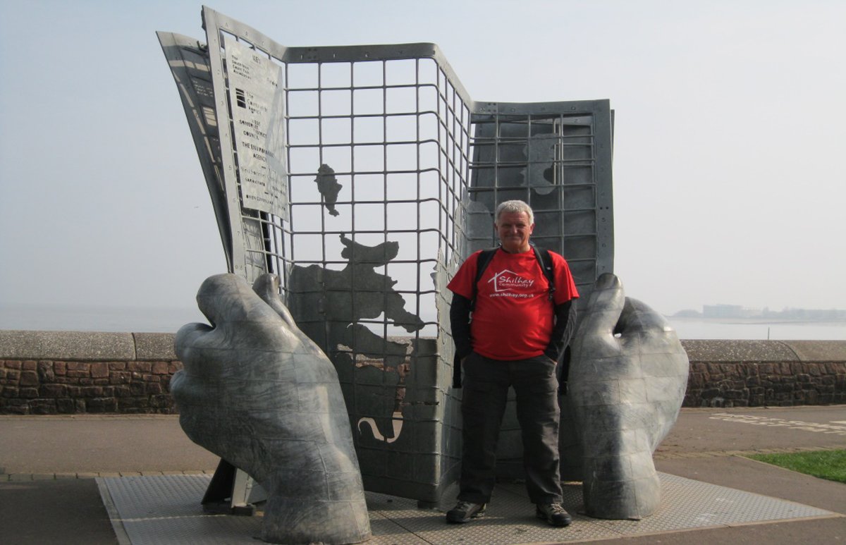
When I retired in 2011 I decided against the pipe and slippers option and set out to walk the South West Coast Path (SWCP). What follows tries to capture the flavour of one of the most rewarding experiences of my life, while also doing justice to the rich variety of people and places I experienced along the way.
What made me do it?
Well, I was 57 years old when made redundant by the Audit Commission, had spent over 30 years working in the public sector and knew that, with a good redundancy payment and pension, I was far luckier than many younger colleagues with mortgages to pay, kids to educate and jobs to find. However, while redundancy came at a good time for me, it still threatened to leave an unexpected vacuum in my life.
I’d lined up some voluntary work as a trustee and outreach volunteer with a homelessness charity, but before settling down to my new life I needed a challenge to mark the transition from work to (semi-) retirement. I’ve always loved mountain walking and, as a Lancastrian exiled in the south west for over 30 years, I’ve come to love the remote moors and spectacular coastal scenery on my doorstep. Combining my passion for walking with my fortunate location, an idea gradually hatched to walk the coast path.
My then partner, Pat, accompanied me at weekends on this barmy long-distance ramble and I cannot adequately express my gratitude for all the help she gave me in supporting my mad endeavour. Even more astonishing is that – despite such clear evidence of instability – she still married me in 2012.
Possibly the best coast walk in the world?
The path wends its way for 633 miles around the bottom left-hand corner of England, from Minehead in Somerset to the edge of Poole Harbour in Dorset, and involves climbing 115,000 ft, or almost four times the height of Everest. It is the UK’s longest national trail and the SWCP Association describes it as “the ultimate challenge for the long-distance walker” offering “some of the finest coastal landscapes to be found anywhere in the world”. Indeed, it’s regularly referred to as one of the world’s greatest walks.
I think the Pacific Crest or Appalachian Trails in North America (at 2,650 and 2,200 miles respectively) could both lay claim to the title of the ‘ultimate challenge’. But after completing the SWCP my initial scepticism has been overcome and I don’t think the SWCP Association’s claims are at all far-fetched. And I say that as someone who has been lucky enough to indulge a passion for walking in more than my fair share of the world’s high places.
I found that the character of the path changes markedly as you travel anti-clockwise around it. From Minehead to Newquay it is sublimely wild and rugged, the feeling of remoteness perhaps amplified for me by walking before the main tourist season began. Newquay was the first really busy tourist town and from there to St Ives it becomes more populated and touristy as the number of settlements and camp and caravan sites increases. My assessment of this stretch was also coloured by the fact that it contained the worst B&Bs on the whole journey (of which more in part 2).
The far west of Cornwall, from St Ives to Falmouth, was enchanting with sustained interest the whole way. Apart from the unremarkable, and at times positively unpleasant, area around Downderry and Plymouth, the remainder of the path, from Falmouth to the finish by Poole Harbour, presents a sequence of pleasant coastal towns and picturesque villages linked by paths that, at times, particularly along the ‘Jurassic Coast’, were as dramatic and tough as anything encountered.
Rocks, dunes and bullets: Minehead, north Somerset, to Bude, north Devon
Back to the starting line at Minehead, where on a sunny March morning many thoughts whirled through my head, but mainly: “What on earth is an overweight 57-year-old doing setting off on an arduous 633-mile hike?”
My fears were not realised, however, as the first couple of days provided a gentle introduction, with moderate gradients, woodland trails bringing the smell of pine and the deafening sound of birdsong, and a charming church to explore in the forest at Culbone.
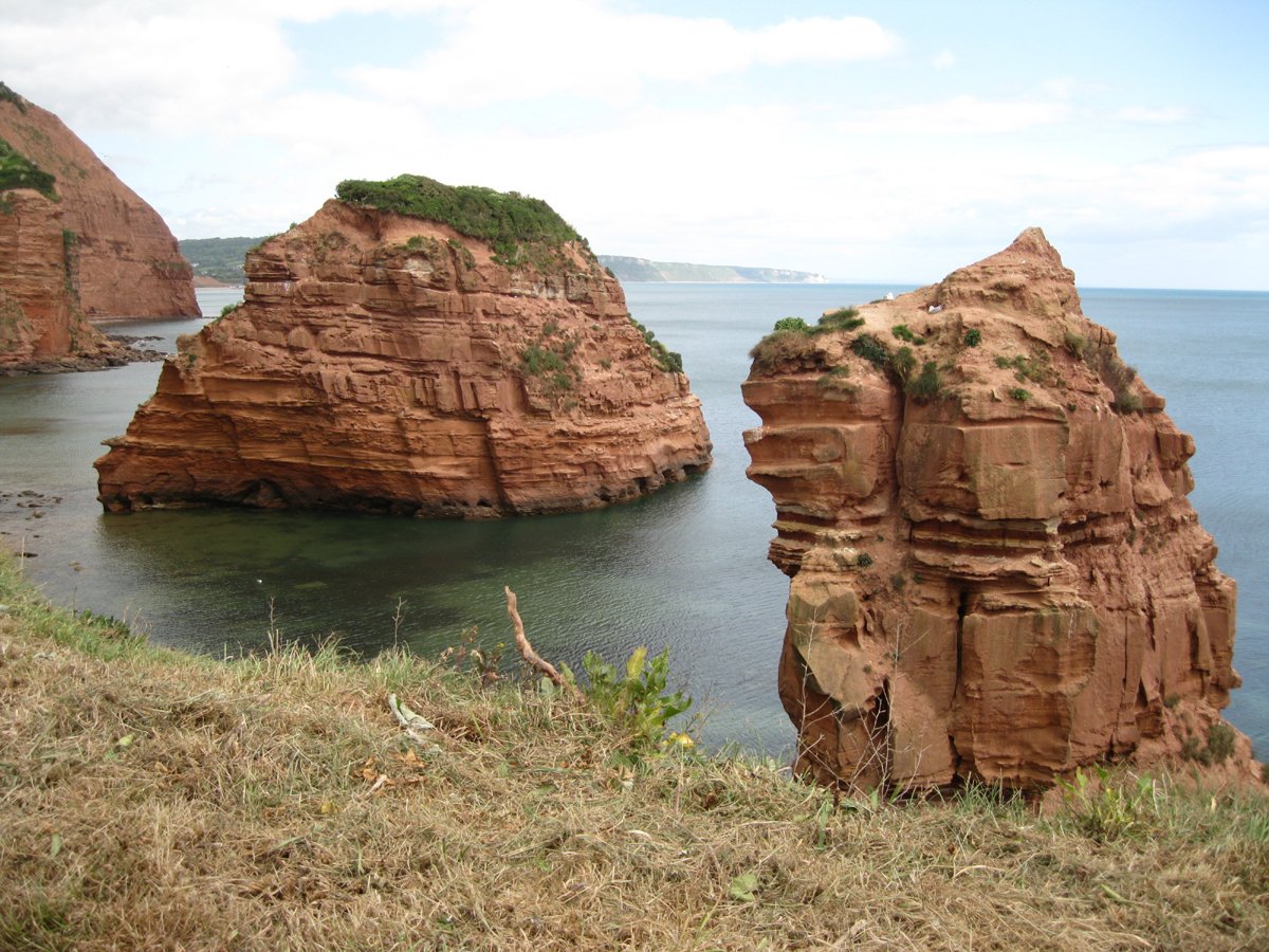
After that things started getting a bit tougher. Just past Lynmouth, on day three, we experienced the sylvan delights of the Valley of the Rocks, where goats graze happily amongst the bracken, beneath jagged rocks rising like turrets from the sea. This was the start of a more demanding 13-mile walk to Combe Martin, the 4,400 ft climb giving notice of some of the challenges ahead. This section took us over Great Hangman – at 1,043 ft, the highest point on the SWCP – but it seemed oddly premature to be passing such a momentous milestone so early on.
After Combe Martin the walk enters spectacularly wild country, with expansive views of Lundy Island, nestling in the Severn Estuary, and lots of climbing on lung-bustingly steep cliff paths. This included the rocky spine of Morte Point, rising jagged from the cliffs like a dinosaur’s back, just before the descent into Woolacombe.
Terrain change
The terrain changed starkly after Woolacombe, as I made my interminable way through the huge sand dunes of Woolacombe Warren – formerly used for D-Day invasion training, but now happily invaded only by surfers. This was followed by Braunton Burrows, an important national nature reserve, part of which is used by the Ministry of Defence for live firing. Hearing the rifles crack incessantly made me uneasy and I began to wish I’d looked to see if Berghaus or Rohan make a gore-tex flak jacket.
More of the same flatlands followed the next day as I walked the Tarka Trail, a path along the Taw Estuary, which I also followed for most of the following day – probably a great day’s biking, but as a walk a bit too ‘much of a much-ness’ for me. The weather did little to improve my mood on this flat meander: a very damp, misty drizzle. I didn’t grumble though, as this was the first rain of the trip!
There were thankfully very few days like these and not many sections fell below the high standards of scenic splendour set by most of the SWCP. However, I would nominate the following as ‘got to be done but unlikely to be repeated’ days:
- the final few miles before Clovelly, along the Hobby Drive – the only interesting thing about this tedious track is that it was built in the early 19th century using labour provided by Napoleonic prisoners of war;
- the tiring, soul-destroying walk through the seemingly never-ending Hayle and Gwithian Towans;
- the long, uninspiring diversion to avoid a land slip just after Lyme Regis;
- the walk past a golf course and china clay works near Par – one of the least appealing sections of the whole walk; and, last and definitely least,
- the walk from Portwrinkle to Plymouth, which my journal records as the “worst day of the whole walk”.
By the time I arrived in Bideford on day six, my body seemed to be getting used to the rhythm of walking 13 miles or so every day and I was starting to accept some of the givens of coastal walking – that the last mile can sometimes feel longer than the previous 13 and that the village you can see apparently ‘just minutes along the coast’ can take hours to reach due to the fact that, inconsiderately, the path has many ins-and-outs as well as ups-and-downs.
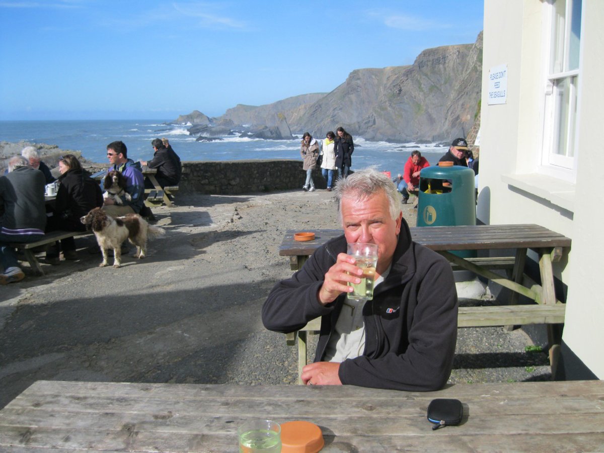
The path from Bideford to Clovelly is a fairly unremarkable section, but from Clovelly things start to get interesting again; the walk from there to Hartland Quay is graded as “challenging” – and it was! We were well rewarded for our efforts at the end of the trail though by a pint in the stunning setting of the Hartland Quay Hotel, one of our favourite stopovers on the whole trip. Coast path walking (or post-walk drinking) doesn’t get any better than this!
This old smugglers’ haunt stands alone at the foot of the cliffs, surrounded by spectacular rocks and crashing waves. To sit with a pint on a sunny evening after a great day’s walking, and another one in prospect, is to enjoy real contentment. Gazing out to sea, I wasn’t surprised to learn that the pub was the setting for the classic 1950’s film of Treasure Island, featuring Robert Newton as Long John Silver.
The 15.4 mile walk from Hartland Quay to Bude fully lived up to its reputation by turning out to be the toughest, but most spectacular, day of the walk so far. This was a day of amazing rocky scenery, but the many ups-and-downs were soul-destroying at times. Time and again the path descends to sea level, only to climb 500 ft or so to the cliff top. I’m sure the number of breathtaking climbs have been documented, but I lost count.
Storms, ‘the Doc’ and foodie delights: Crackington Haven to Padstow, north Cornwall
The 10 miles from Bude to Crackington Haven were another walk described as “challenging”, but the hardships were compensated for by the cliff-top views over the wild Atlantic and the many charming waterfalls tumbling down from above the path. Along this stretch I passed a bench with the SWCP logo and the legend “Poole 500 miles” – a sobering thought.
The next day dawned misty, wet and windy in Crackington Haven, the first really heavy rain of the walk so far. The spectacular view from the hotel’s breakfast room of huge waves breaking over jagged rocks did not allay the nagging thought that, sooner or later, I was going to have to go outside and get very wet.
Another challenging day followed, one of many along this wild, remote, but beautiful, part of north Cornwall. After an unrelentingly stormy day, amid fantastic scenery and along one of the most exposed sections of the path, I checked into my pub accommodation in Tintagel, a town whose local economy is highly dependent on the Arthurian legend.
The 9-mile walk from Tintagel to Port Isaac was a cracker and yet another graded “challenging”. Although there were seven deep valleys to cross, I coped well and felt I was getting fitter on the hills.
Port Isaac has been popularised by the TV drama Doc Martin and my excitement mounted as I found they were filming; my hopes of landing a walk-on part as ‘dour northern hiker’ or ‘passing village idiot’ rose as I sashayed seductively past the cameras and lighting rigs on the slipway.
‘The Doc’ connection is doing for Port Isaac what Rick Stein has done for Padstow – certainly if the price of B&Bs is anything to go by. Conventional wisdom is that exposure on the telly is a great thing for a local economy. Yet most of the local people I spoke to said that the film crew were a real imposition and that they couldn’t wait to get their village back after the “occupation”. There is clearly some tension; many shops do display signs saying, “We support Doc Martin”, but a friendly barmaid told me that she found the intrusion “very disruptive to village life”. That was certainly my experience after just one night at the (excellent) Slipway Hotel. I guess it all depends on whether you’re making any money from ‘the Doc’.
Filming was going on outside my room and the bar was full of self-important and very loud film crew. The guy at the next table sounded as if he had imbibed something a whole lot stronger than Doom Bar bitter judging by his agitated demeanour and hysterical, honking laugh, which came at quite inappropriate points in the conversation. If you’ve ever heard the cry of an abused barnacle goose (and who hasn’t?), you’ll get the picture.
After my brush with the big-eared medic, I approached Rock and the Camel Estuary, and the path got decidedly busier. This was the school holidays in one of Cornwall’s most popular tourist destinations after all, so why should I be surprised? A culture shock, nonetheless, after weeks of relative solitude.
Padstow and Rick Stein
After crossing the River Camel to Padstow, home of the Rick Stein seafood restaurant and the lucrative empire of other ancillary businesses that have mushroomed with it, we walked up the hill to what was one of our favourite B&Bs, 50 Church Street. We have such happy memories of a spacious house, dating back to 1735, and a really friendly welcome; a large well-appointed room and an excellent breakfast made our stay complete.
I heard mixed responses to Rick Stein. With his restaurants, hotel, pub, cafes and delis he has undoubtedly brought many jobs to Padstow and his name clearly pulls in a lot of visitors. Like Port Isaac and ‘the Doc’, most B&Bs make the most of the connection and reflect it in their prices. However, I can’t help but feel sad that, because of this upmarket Harry Ramsden’s, many youngsters can no longer afford to stay in the place of their birth.
Surfers, seals and soliloquy: Porthcothan to Porthcurno, west Cornwall
The walk from Padstow to Porthcothan was sunny but uneventful. The next day’s walk to Newquay began in similar splendid isolation, until the wilderness of Hartland Point became a distant memory, and the path became more and more touristy as it neared the stag party and surfing capital of the UK. I had found Woolacombe a culture shock, but it was positively sedate compared to its big brother in the surfing family.
The atmosphere in these surfing towns was such a contrast to the rest of the coast – like moving from a National Trust promotional video to an amateur production of Baywatch with one flick of the remote control. In particular, I thought that Westward Ho!’s apparent attempt at being a surfing centre was just sad. It would perhaps have been more accurate if Charles Kingsley had named this ‘last resort’ “Westward No!”
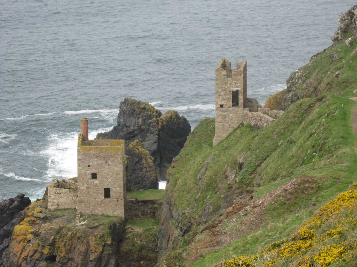
After another surfing mecca, Perranporth, the path passes a number of atmospheric old tin mines. I thought these were impressive and they proved a taster of the really picturesque old engine houses dotted along the path near Lelant, in wild west Cornwall.
Two hours into the 12.5-mile hike to Portreath, the rain started and ‘persisted down’ for the rest of the way. I couldn’t really grumble though, as I’d had far fewer wet days than expected, but that didn’t make me feel any better as I trudged disconsolately along the rain-sodden path.
Portreath to St Ives
The 18-mile walk from Portreath to St Ives was soul-destroying, with far more steep climbs than I had expected. But just when I was thinking that this was going to be a relatively ordinary day, I witnessed a most extraordinary sight.
As I neared Godrevy Point, I began to notice more and more ‘casual walkers’, people who had strolled the few hundred yards from the National Trust car park. Many of these folk were clustered along the cliff top looking down towards a cove. I realised why they were so excited when I saw over 30 seals, including many pups, swimming around or basking on the beach. I had only seen three seals since starting the walk in Minehead, so to see this number in one place really was special.
Another tough day from St Ives to Pendeen, but we were rewarded at the end by an excellent B&B, the North Inn, an unpretentious former tin-miner’s hostelry – until the mines closed in 1990. This was the cheapest billet of the whole trip and one of the best. A very large room in a separate, modern chalet block, with a very welcome bath, and a balcony offering (distant) sea views. In the pub, stone floors and granite tables surround a well-stocked bar with a surprisingly extensive curry menu. A former ‘Cornish Pub of The Year’: I’m not surprised.
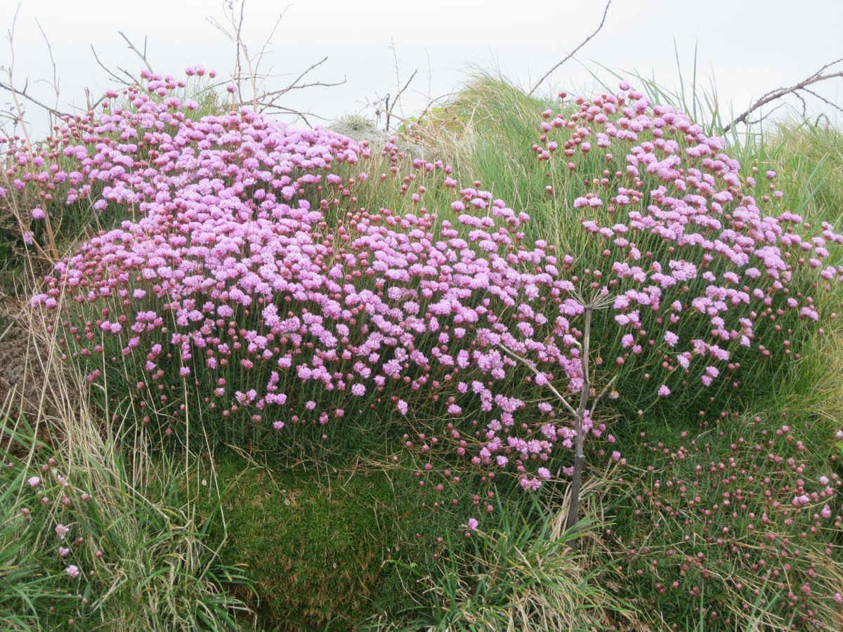
The yellow and pink flowers covering the cliffs between St Ives and Pendeen made a colourful backdrop to our day. There was an abundance of flora and fauna on the coast; other noteworthy ‘wow’ moments being:
- our very best day’s ‘spotting’ between Pendeen and Sennen, when I saw several kestrels flying alongside us at cliff-top level, four iconic choughs, a host of wild flowers, three seals and an adder;
- the huge number of bluebells, sea pinks and wild garlic, together with deafening bird song, around Gillan Creek and on the path from there to Falmouth; and
- the overpowering smell of wild garlic around Branscombe – scene, in 2007, of the wreck (and subsequent looting) of the container ship MSC Napoli.
Sennen to Lamorna was one of my favourite days. Along with a wealth of wildlife, I had a wonderful view of Wolf Rock Lighthouse in the foreground and the occasional glimpse of the Isles of Scilly in the far distance. Lands’ End rather interrupts the peace and tranquillity though and our pace quickened as I passed this eyesore. What was once a lovely, unspoilt stretch of coastline has become a kind of theme park, with a range of features all designed to part the tourist from their holiday money.
I walked quickly past this ‘Wolf-Rock(y) Horror Show’ and headed towards the delights of the Minack Theatre at Porthcurno – an auditorium carved out of the cliff side and an amazingly atmospheric place to watch a performance. Pausing only for a quick soliloquy, I forged on to Lamorna.
From Penzance to Portloe, south Cornwall, (and a detour to the Royal Devon and Exeter!)
After walking around Mounts Bay and through Penzance – which seemed like a metropolis after what had gone before – the geology changed noticeably, with lots of serpentine rock in evidence. This is very attractive, but also very slippery on the many stone stiles. There is a real cottage industry in serpentine jewellery and other knick-knacks in this area.
After rounding the Lizard, Gillan Creek was a joy, as was our accommodation. At our B&B, a private house called Kerenza, we were greeted with a pot of tea and slices of homemade cake in a sunny garden. Because it is some distance from the nearest eatery, our host prepared a meal; this comprised three courses, complete with wine, and was such a pleasant change from the pub fare we had endured for most of the walk thus far.
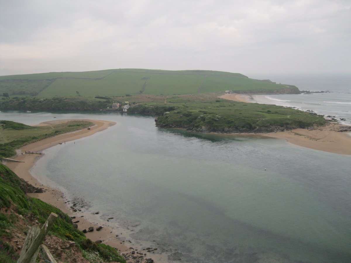
From here we hailed the ferry across the river to Helford Passage. The ferries were a highlight of the walk for me – probably because they gave me a breather! Other memorable river crossings were:
- the small ferry across the Percuil River from St Mawes to Place;
- crossing the Avon from Bigbury to Bantham (of which more in part 2);
- wading across the River Erme, which can only be crossed on foot a couple of hours a day when the tide’s out; and
- crossing the Yealm at Noss Mayo, which was a delight, as was the friendly boatman who took me across.
Struck down!
After a rest day in Falmouth, the 14 miles from Place to Portloe should have been another pleasant walk, but a nasty cough I’d had for a few days was getting progressively worse and I was feeling too ill even to enjoy the bluebells covering St Anthony’s Head. By the time I reached my accommodation in Portloe, I was feeling rough due to a rising temperature and persistent cough. Despite my condition deteriorating overnight and feeling ‘clammy’ at breakfast, I tried to carry on the next day in the hope that I could walk it off. I soon began to feel very weak, and after two and a half slow miles, I reluctantly bowed to the inevitable at East Portholland and accepted that I needed medical attention.
I made my way to the Royal Devon and Exeter Hospital’s drop-in centre, where I received first-class treatment and was diagnosed with a severe chest infection and a worryingly high temperature. I was given a seven-day course of antibiotics, paracetamol and a stern warning that if I tried to restart the walk too soon, I would “end up in Truro hospital with pneumonia”.
Back on the trail: Bigbury on Sea to the Dart Estuary, south Devon
A week later I found myself on a wet, windswept and desolate beach at Bigbury on Sea, trying to hail the ferry across the River Avon to Bantham. I began to regret leaving my sick bed and wondered if, after weeks of glorious weather, my luck had finally changed. I really couldn’t complain if it had.
The 13.7-mile walk to Salcombe started gently, passing through a deserted Bantham and then a succession of coves with road access. However, after the picturesque Hope Cove it got tougher, particularly in the rain and the cold wind. On a better day the later section of this walk is spectacularly attractive, but not that day, sadly.
The perils of having insufficient rest were brought home to me just after Bolt Head, as I passed a man stumbling wearily along the path to Salcombe. Doing the whole SWCP for a prostate cancer charity in memory of his father, he looked a human wreck. He was relying heavily on his walking poles and carrying a huge pack, complete with two large swinging collection boxes. He replied to my query about his wellbeing by reeling off a litany of ills, including shin splints, dodgy knees and a sore ankle. When I said that I found a weekly rest day enabled me to keep going without getting injured or too exhausted, to my amazement he explained that he was looking forward to his first rest day since starting out weeks before in Minehead! While admiring his determination and commitment to charity fundraising, I found his planning skills less admirable in the light of what seemed to me a suicidal schedule. I really hope that he made it to Poole Harbour, but question the wisdom of attempting to walk from Minehead to Salcombe, a distance of 452 miles, with a heavy load and without a break.
On the walk from Start Point to Dartmouth, I paused for thought at Slapton beside the Sherman tank that was recovered from the sea a few years ago. This tank is now a memorial to the men who died when a pre-D-Day training exercise, Operation Tiger, went horribly wrong and a German motor torpedo boat launched a deadly surprise attack.
Despite a very long inland diversion after Slapton Sands – which made it less of a coast walk and more of a country ramble – this was another good day. My reluctance to leave the coast was soon forgotten and it was interesting to explore the sleepy villages of Strete and Stoke Fleming. The final few miles around the Dart Estuary were a pleasure.
Jurassic wonderland: Orcombe Point, south Devon, to ‘starkers’ Studland, south Dorset
After traversing familiar territory around Torbay, I arrived on the Jurassic Coast. This fossilised wonderland stretches from Orcombe Point at Exmouth to Old Harry Rocks, near Swanage, and was designated a UNESCO world heritage site in 2001 – the only one in England. I was lucky to share much of this spectacular stretch of coastline with Pat.
After Branscombe the path wends its way along the beach for a while before striking off steeply across the undercliff to climb a few hundred feet to the cliff top. This is an enchanting path over an area where a landslip has produced an irregular and heavily vegetated landscape of peaks, gullies and massive slipped blocks.
Into Dorset
My memorable B&B in Abbotsbury shared premises with a lovely tea shop and my room was an old ‘apprentices cottage’. The nicest touch was the cream tea on the lawn on arrival. Such a warm welcome was rare and all the more impressive because of that. I never object to paying a premium for quality accommodation and good service; yet (and I’ll expand on this in part 2) so many B&Bs on this walk charged a premium for the bare essentials.
The walk from Abbotsbury to Weymouth far exceeded my expectations. A long, exhilarating ridge, with panoramic views over Abbotsbury Swannery and the channel, led down to a path running along the edge of the Fleet, a fresh-water lagoon between the 18-mile-long strip of shingle that is Chesil Beach and the mainland, which took me almost all the way to Weymouth.
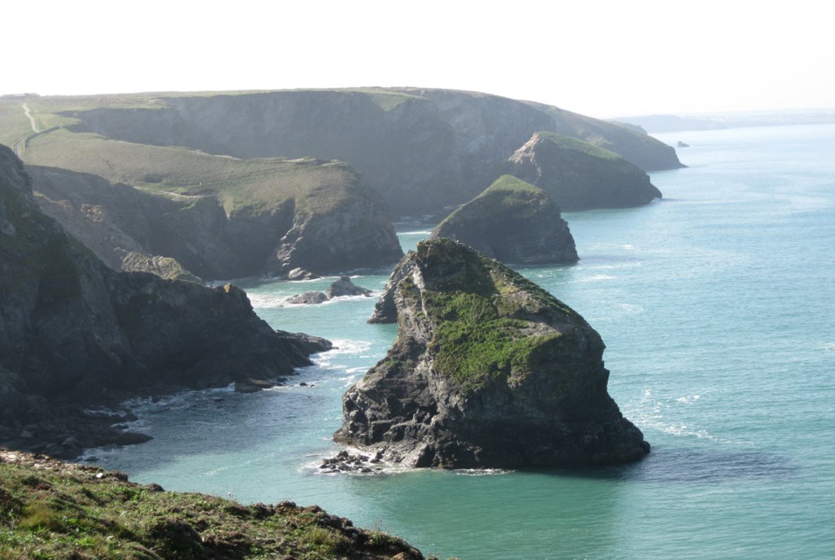
The path from Weymouth to Lulworth was an 11-mile ‘walk of three parts’. Very flat along the promenade around Weymouth Bay, then a pleasantly undulating path for a few miles, finishing up and down 3 miles of steep, but lovely, chalk cliffs towards the natural limestone archway of Durdle Door – probably the most photographed landmark on the whole south coast – then on to Lulworth Cove.
I had more great weather for what was a tough day from Lulworth Cove to Worth Matravers. The first half was very hard, but eased off (a bit) after Kimmeridge. It is well worth waiting for a day when the guns fall silent and you can traverse the permissive path running alongside the military firing ranges, rather than take the suggested inland alternative. I consider this to be one of the top three days of the whole SWCP, so it must be savoured to the full!
My guide book’s advice that after Kimmeridge the path “continues to rise steeply to the heights of Houns-tout cliff” doesn’t really do justice to the lung-bursting qualities of this limestone peak. Then, just when you think the worst is over and you’re nearing the end of the trail, you still have to contend with a long, steep staircase to the top of St Aldhelm’s Head and its Norman chapel. St Aldhelm, the 7th century Bishop of Sherborne, appears to have been a right clever dick, who set up a number of monasteries and had his writings commended by the Venerable Bede.
Had I not lost a week, the walk from Worth Matravers to South Haven Point would have been the finish. It was strangely ‘ordinary’ and uneventful until Studland Bay, with its population of mainly male, and rather exhibitionist, naturists. As we gazed at the array of sagging posing pouches and upturned bronzed buttocks, I mused that if I’d brought my bike, I wouldn’t have been short of a place to park it.
No cheating! Portloe, south Cornwall, back to Bigbury, south Devon – for the part I’d missed out
Then it was back to Portloe in Cornwall to complete the day I’d failed to complete at the first attempt and continue to Bigbury on Sea, where I’d restarted after my week off.
I felt a lot fitter than I felt the first time round. All I remember from that dreadful day was gasping for breath as I struggled up the most modest of hills. For the restart the weather was glorious and I seemed to reach Mevagissey in no time at all.
The words “hills” and “strenuous” leapt out of the guidebook’s description of the 10.7-mile walk from Mevagissey to Par – and they weren’t kidding. Surprisingly tough in the early stages, the walk was nonetheless very enjoyable until Pat left me at Charlestown, the picturesque harbour featured in The Onedin Line.
As the realisation dawned that I wasn’t going to be offered the part of a drunken sea-dog in the next seafaring adventure to be filmed here, I pressed on past a golf course and china clay works on what I described earlier as one of the least appealing sections of the whole walk.
The path became more dramatic after Looe, with many steep climbs, but soon degenerated through less interesting terrain populated by soulless, unattractive settlements. The glut of sub-standard holiday accommodation around Downderry was very striking and not a little depressing.
As there was a dearth of accommodation in Par, Pat drove me to Fowey for our stopover. The B&B was not quite what we were expecting from the fulsome description on the website. However, full marks for the owner’s powers of creative writing and for making the most of what she’s got. The website mentioned that the establishment’s three hens ambled around the garden. Picturing an old, rustic farmyard scene, we double-checked our map (and vision) when we arrived at a modern housing estate. True, the hens – Faith, Hope and Charity – could be spotted in the garden, but they were confined to a small hut, not unlike a dog kennel.
This quirky B&B proved to be one of our favourites; thoughtful features included fresh milk from the in-room fridge and a comprehensive information pack about the local area. Breakfast was excellent and the proprietor bent over backwards to make our stay enjoyable (and it’s difficult cooking bacon and eggs in that position).
I had expected to get progressively fitter as the weeks went by, but now the reverse seemed to be happening and I felt weary, making hard work of sections that I would have had no trouble with a few weeks earlier. I felt it was all catching up with me – that, coupled with the generally drab nature of much of this section of the walk, made for one of the very few days that I wished it was all over with.
The traverse of Plymouth, with its atmospheric Barbican and naval dockyards, was interesting, but the big city is very out of kilter with the tranquillity of most of the path. It was a relief to reach the enchanting yachtie haunts around Noss Mayo and Newton Ferrers, before finally arriving at Bigbury on Sea, the point from which I’d restarted after getting sick.
All that was left was the short drive from my home to Babbacombe and the familiar walk back from there to finish at my house in Dawlish. It was a strange feeling, but a warm one, to finish on my own doorstep and celebrate with Pat and our best friends, who had supported me so much throughout the walk.
Follow that!
My elation at finishing was not to last, however, and I discovered that ‘coming down’ from my coast path high would be harder than I’d expected.
Going back to my new life as a retiree had an impact I would never have imagined. I’m reluctant to use the word ‘depressed’, as that is insulting to those who have something to be depressed about, but I did experience some pretty wild mood swings.
Of course, it wasn’t just (or even mainly) the walk. Completing the SWCP just happened to coincide with a major change in my life – retirement. You don’t realise how important a job is until it’s not there. I had been lucky enough to love my job, so when it was gone there was a huge gap to fill. The odd thing was that I had dreamt of early retirement – why wouldn’t I, having lots of interests to fill my time and a good pension to fund our travel plans? So, nothing could have prepared me for the unexpected sense of loss I felt.
I’ve been informed by Pat and a couple of good friends that my behaviour did change: they tell me that I became a little withdrawn and a lot bad tempered. Although I realise this now, I didn’t acknowledge it at the time. After a few months of unreasonable behaviour, I settled into a new routine and have kept busy since with volunteering and the odd public appointment. Life is good and I feel guilty that, having so much going for me, I felt so sorry for myself.
I hope that it’s clear from the above that I love the SWCP and never tire of repeating favourite sections (well I get a bit tired, but that’s just old age). I would advise anyone contemplating walking it to ‘get your boots on’ and just do it!
In planning any walk on the SWCP, I would heartily recommend the SWCP Association’s website, which provides a wealth of handy information, including a very useful distance calculator.
Gluttons for punishment who’d like to read a far more detailed account of my walk should visit: Over the hill – on the South West Coast Path: random ruminations of a rambling retiree.